Geospatial Analyst

Chalaka Priyashantha

UAV LiDAR, Photogrammetry and Thermal

This portfolio presents selected geospatial project case studies highlighting my direct technical involvement in end-to-end UAV LiDAR, photogrammetry, bathymetric and remote sensing deliverable production across environmental monitoring, water resources, forestry, coastal conservation and agriculture.

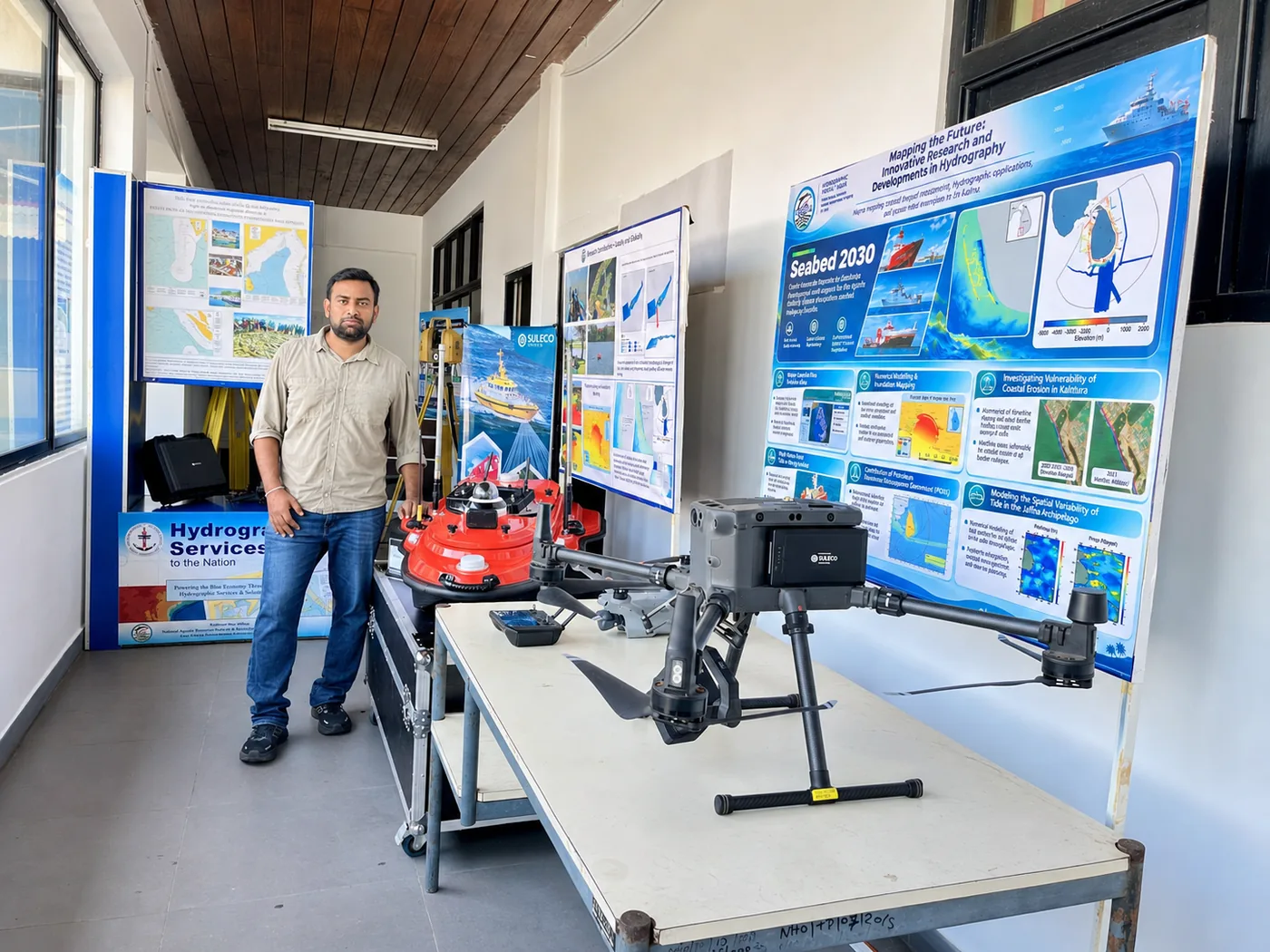
Chalaka Priyashantha standing beside a DJI Matrice 300 RTK survey drone and an orange South unmanned survey vessel at a hydrography exhibition.

End-to-end geospatial production workflow

The same five stages run through every project, from the first planning call to the final handover.

  1. 1

    Survey Planning and Control

    Requirement and AOI review, datum confirmation, mission and GNSS planning, RTK/PPK selection, GCP and check point strategy, flight safety and weather checks.

  2. 2

    Data Acquisition

    UAV LiDAR, RGB, multispectral and thermal capture, with GNSS control, check points, spot heights and field verification.

  3. 3

    Processing and Classification

    Trajectory and georeferencing review, point cloud generation, noise filtering, ground classification, DTM/DSM/CHM/TIN and orthomosaic production.

  4. 4

    GIS/CAD Analysis and Production

    Terrain and remote-sensing analysis, then contours, profiles, cross sections, GIS-ready datasets, DWG, LandXML, PDF maps and LAS/LAZ outputs.

  5. 5

    QA/QC and Handover

    Coverage, control and classification checks, accuracy and RMSE review, metadata, a deliverable register and structured client handover.

Planning, field acquisition, processing and GIS/CAD outputs across the five stages.

Projects

Six selected projects delivered with SULECO (Pvt) Ltd. Each one separates my own technical role from work completed by other team members.

01

Coastal LiDAR Survey and Environmental Mapping Project

Client
Coast Conservation Department (CCD)
Locations
Kalutara, Kalpitiya, Sandikadu, Magama, Ulla and Panama
Coverage
Approximately 850 ha
Duration
Dec 2024 – Feb 2025
Category
Environmental Monitoring / Coastal Mapping

About the project

SULECO conducted a UAV LiDAR and high-resolution aerial mapping project for selected coastal zones under the Coast Conservation Department. The work captured coastal terrain, surface features, infrastructure and land use to support coastal monitoring and environmental management. Field activities covered LiDAR and imagery acquisition, control point and GCP measurement, spot height collection and ground verification.

My technical role

I led the UAV LiDAR survey, processing and output preparation. Using a DJI Matrice 300 RTK with Zenmuse L2, I captured RTK aerial LiDAR data and processed it in DJI Terra and LiDAR360 to produce terrain outputs, contour datasets and GIS-ready mapping products. I also ran the QA/QC checks on consistency, classification quality, contour behaviour and accuracy using ArcGIS, QGIS and Civil 3D.

Key deliverables

  • High-resolution orthophoto maps for selected coastal zones
  • LiDAR-derived DTM, DSM and detailed contour datasets
  • Cross-profile and transect outputs for terrain interpretation
  • Infrastructure asset and land-use mapping outputs
  • Ground control, check point and GIS-ready spatial deliverables

Outcome

Accurate coastal datasets for multiple priority locations, supporting shoreline monitoring, asset documentation, land use assessment and evidence-based coastal zone management.

Kalutara: orthophoto, terrain model, CAD plan, transect profiles and drawing sheet.
02

Maussakele and Castlereigh Reservoirs Bathymetric and Topographic Survey and Terrain Analysis

Client
Ceylon Electricity Board (CEB)
Location
Maussakele and Castlereigh Reservoirs
Coverage
1,045 ha bathymetric survey and 4,000 acres topographic survey
Duration
Feb 2025 – May 2025
Category
Water Resources / Hydrology / Environmental / Energy

About the project

SULECO completed an integrated bathymetric and UAV-based topographic survey of the Maussakele and Castlereigh reservoirs. Bathymetric data were collected at 10 m intervals to represent the reservoir bed, while UAV topographic mapping up to HFL + 2 m captured the surrounding terrain and reservoir boundary. Together they support reservoir management, hydrological assessment and capacity evaluation.

My technical role

I was responsible for the UAV topographic survey of the reservoir land area and surrounding terrain, using RTK and PPK aerial LiDAR with a DJI Matrice 300 RTK and Zenmuse L2. The bathymetric field survey was carried out by another team member. My work covered LiDAR processing, bathymetric dataset integration support, point cloud classification, terrain model analysis and GIS/CAD-ready outputs in DJI Terra, LiDAR360, ArcGIS, QGIS and Civil 3D. I reviewed surface continuity, contour logic and boundary consistency before submission.

Key deliverables

  • UAV topographic survey datasets up to HFL + 2 m
  • LiDAR-derived terrain models and reservoir contour datasets
  • Integrated outputs combining surrounding terrain and reservoir survey data
  • Final maps, drawings and technical survey data for engineering analysis
  • Verified raw and processed datasets for reservoir management

Outcome

A stronger basis for reservoir capacity evaluation and long-term water resource planning, combining topographic context, bathymetric data and engineering-grade maps.

Orthomosaic, terrain model and contour map for each reservoir.
03

Weddemulle Estate Aerial Survey, Land Use Analysis and Contour Survey

Client
Agalawatte Plantations PLC
Location
Weddemulle Estate, Ramboda
Coverage
Approximately 450 ha
Duration
June 2025
Category
Agriculture / Plantation / Hydrology / LULC

About the project

SULECO conducted an aerial LiDAR and imagery survey of Weddemulle Estate to support outer boundary mapping, land use mapping and topographic analysis. Field work included UAV data capture, primary control establishment, ground control measurements and spot height collection for accurate positioning and elevation referencing.

My technical role

I carried out the UAV LiDAR and imagery survey workflow with a DJI Matrice 300 RTK and Zenmuse L2 using RTK/PPK methods. I handled aerial acquisition, LiDAR processing, point cloud classification, orthophoto interpretation, terrain modelling, land use classification and contour-ready datasets, using DJI Terra, LiDAR360, ArcGIS, QGIS and Civil 3D, from survey execution through to final delivery.

Key deliverables

  • UAV LiDAR and aerial imagery datasets for the estate
  • High-resolution 2D imagery at 15 cm/pixel
  • Primary control, ground control and spot height information
  • Outer boundary survey plans, land-use maps and topographic outputs
  • Contour and terrain datasets for plantation management

Outcome

Accurate boundary, land use and topographic information supporting estate administration, plantation planning and operational land management.

Point cloud and profile, hillshade with drainage, elevation model and land use map.
04

UAV LiDAR-Based Forest Extent Mapping and Individual Tree Inventory

Client
Browns PLC
Location
Hapugastenne Plantation
Coverage
Approximately 154 ha
Duration
July 2025
Category
Forestry / Plantation

About the project

SULECO built a spatial forestry database for Browns PLC at Hapugastenne Plantations from UAV LiDAR captured with a DJI Matrice 300 RTK and Zenmuse L2. The point cloud was classified to derive terrain, canopy and vegetation structure, and individual trees were segmented to extract location, height, crown diameter, crown area and crown volume. These outputs support plantation inventory, biomass estimation and carbon stock evaluation.

My technical role

I was the project responsible person for the UAV LiDAR survey, processing and forestry analysis. I planned and conducted the aerial survey, processed the point cloud in DJI Terra and LiDAR360 (cleaning, classification, terrain modelling and canopy-structure analysis), interpreted forest extent, segmented individual trees and extracted their attributes. I prepared GIS-ready layers, maps, tables and report outputs in ArcGIS and QGIS.

Key deliverables

  • UAV LiDAR point cloud for the plantation forestry area
  • High-resolution 2D orthophoto, DEM, DSM and CHM
  • Individual tree segmentation layer with tree ID and location
  • Tree attribute table: crown diameter, area, volume and height
  • Forestry inventory maps and GIS layers

Outcome

Accurate forest extent, canopy structure and tree-level attributes for plantation documentation, tree inventory and future monitoring of canopy change, biomass trends and carbon assessment.

Orthophoto, canopy height model, tree segmentation with attribute table and a single-tree view.
05

Cyclone Ditwah: Flood, Landslide, Environmental and Crop Damage Analysis

Client
International Water Management Institute (IWMI) and Disaster Management Centre (DMC)
Locations
Kelani River floodplain, Gatambe, Peradeniya, Kothmale, Mawathura, Dolosbage, Daduru Oya, Rajanganaya and selected agricultural areas
Duration
Dec 2025
Category
Disaster Risk Management / Environmental Assessment / Agricultural Damage Mapping

About the project

After Cyclone Ditwah struck Sri Lanka in late November 2025, we carried out rapid UAV data acquisition and analysis for multi-site damage assessment across floodplains, landslide-prone terrain and irrigated farmland. LiDAR, RGB, multispectral and thermal data were processed into DEMs, DSMs, orthomosaics, vegetation and water index maps, flood extent maps, thermal outputs and damage interpretation layers.

My technical role

I was responsible for multi-sensor UAV data acquisition, processing and GIS analysis. I captured LiDAR, RGB, multispectral and thermal data with a DJI Matrice 300 RTK with Zenmuse L2, a Zenmuse H20T, a DJI Mavic 3 and a DJI Mavic 3M. My processing covered DEM/DSM generation, orthomosaics, NDVI/NDWI analysis, thermal mapping and the flood, landslide and crop damage layers, using DJI Terra, LiDAR360, Agisoft, Pix4D, ArcGIS and QGIS.

Key deliverables

  • UAV LiDAR point clouds, DEM/DSM and high-resolution orthomosaics
  • Flood extent and inundation maps
  • Landslide terrain assessment outputs
  • NDVI, NDWI and related multispectral index maps
  • Thermal interpretation maps and crop damage layers

Outcome

Timely spatial intelligence that helped IWMI and DMC identify affected areas, understand terrain-related risks, evaluate crop damage and plan evidence-based post-disaster action.

Orthomosaics with thermal and vegetation-index maps from flooded, farmland and landslide sites.
06

Nilwala River Aerial LiDAR and Bathymetric Survey

Client
Institution of Engineers, Sri Lanka (IESL)
Location
Lower Nilwala River, Matara, Sri Lanka
Coverage
42 river cross-sections and adjoining riverbank terrain
Duration
Sep – Nov 2026
Category
Water Resources / Hydrology / River Mapping

About the project

SULECO completed an integrated aerial LiDAR and bathymetric survey of the lower Nilwala River for IESL, documenting riverbed elevations, channel geometry and bank terrain to support assessment of sedimentation, drainage and flooding around the Nilwala salinity barrier. Selected 2026 cross-sections were presented alongside digitised 2015 and 2023 profiles for indicative visual comparison.

My technical role

As team leader, I managed the complete workflow from survey planning and data acquisition to processing, analysis and final submission. With support from the field crew, I conducted the aerial LiDAR survey with a DJI Matrice 300 RTK and Zenmuse L2 and ran the bathymetric survey with the SOUTH M20 USV. I processed both datasets, integrated riverbed and bank elevations, digitised the historical profiles, prepared the cross-sections and CAD drawings, and carried out the quality checks.

Key deliverables

  • UAV LiDAR point cloud and riverbank terrain datasets
  • Integrated riverbed and bank profiles for 42 cross-sections
  • River plan and cross-section drawings referenced to SLD99/MSL
  • Indicative comparisons with digitised historical profiles
  • Processed survey datasets and final CAD/PDF outputs

Outcome

Updated riverbed and riverbank information for IESL’s assessment of channel conditions and later hydraulic studies. All required datasets, drawings and technical outputs were submitted.

Survey route, LiDAR and bathymetry strips, CAD plan view, river orthomosaic and cross-section L24.

For confidentiality and data security, this portfolio does not reproduce client deliverables, raw datasets, detailed drawings, coordinates or native project files. Selected screenshots and representative visuals demonstrate workflow, technical contribution and output types only.

PERSONAL, SCIENTIFIC AND PROFESSIONAL BACKGROUND

Farming Roots | Geology Education | Geospatial Practice

I grew up in a farming family in Ussan, Sri Lanka’s North Central Province, where everyday life was closely connected to the land, water and changing seasons. Studying geology at the University of Peradeniya gave me a scientific foundation for understanding environmental processes, while my work as a geospatial analyst at SULECO has developed my skills in surveying, mapping and analysis. The photographs below reflect these connected parts of my background and the experiences that continue to shape my interest in the environment.

Nearby forest, over view of our farm land and the cattle management
Crop management and irrigation
Explaining how UAV and USV technologies can support hydrological and ecosystem monitoring at the IWMI Open Day.
Graduation, University of Peradeniya, Sri Lanka.

Get in Touch

For survey projects, collaborations or questions about any of the work above, send a message and I will reply by email.